Honestly, I don’t know if there is a better road trip than exploring America’s Southwest. There are so many things to see that you’d need months to tour all the wonderful sights located in this part of the country. You can, however, see quite a bit, even if you only have a week or two available. Since we decided to spend Christmas of 2019 with family in Dallas, we knew that a drive from Seattle would provide us with great opportunities for sightseeing. We’d done this drive in sections before but this area of the country is so spectacular, so why not do it again? Here is how we spent 2 weeks on the road through America’s Southwest. The loop described below starts and ends in Salt Lake City.
On the Road through America’s Southwest - Utah
Spanish Forks - Moab
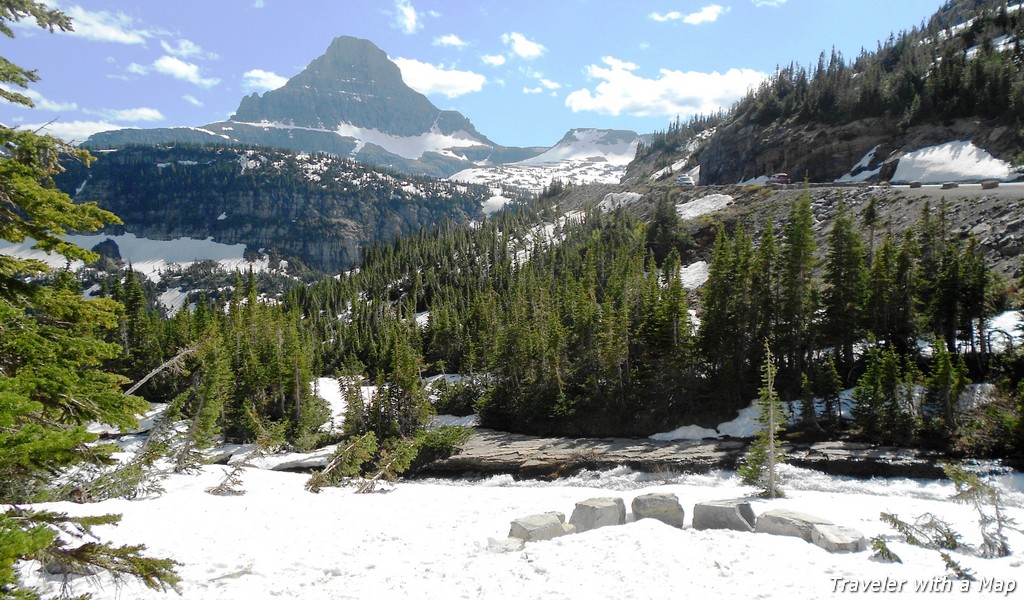
After a night in Pendleton and another one in Salt Lake City, we set off on our adventure. We took Hwy 6 from Spanish Forks to Price. The highway goes through a canyon, and you will see lovely outcroppings along the way. The canyon then opens up into a pretty valley, which, this time of year, was blanketed by snow. The mines located here have lots of history. Butch Cassidy and the Sundance Kid apparently robbed the mining company payroll in this area. Once you reach I-70, you will have nice views of the La Sal Mountains.
As you approach Moab along Hwy 191, you’ll start seeing some interesting rock formations in the distance. As you get closer to Arches National Park, the rocks will be right by the road. The views are spectacular. Arches National Park is a must stop if you haven’t been there yet. We have been there multiple times, so we skipped the park this time.
The drive out of Moab is beautiful as well. Again, you’ll pass amazing rocks formations, Wilson Arch being one of them.


Canyonlands National Park, the Needles District
Before you actually enter the Needles section of Canyonlands National Park, you will pass by some amazing land formations along state route 211: red rock canyons, mesas, buttes, eroded pillars, and boulders. Make sure to stop by the Newspaper Rock to see elaborate Navajo petroglyphs. They are certainly interesting.
We’ve been to the Island in the Sky District of Canyonlands National Park before but this was our first time in the Needles District. I must say, the park is spectacular. The name comes from the variety of spires that look like needles from afar. The scenic drive is beautiful and the overlooks boast amazing views. We took a mile-long hike to see the needles and loved it. You can read more about the Needles Section of Canyonlands National Park here.


On the Road through America's Southwest - Utah/ Arizona
The Valley of the Gods and Monument Valley
After spending the night in Blanding, we headed towards Monument Valley. The scenery was breathtaking again – Utah State Route 95 W takes you through stunning slickrock country. It’s hard to express in words the beauty of the land here. Exploring America’s Southwest, especially Utah, will keep you in awe for hours.
Natural Bridges National Monument is right in the area. It may be worth a brief detour to see the amazing sights. Since we’d already been there, we skipped it this time. Instead, we turned onto highway 261 South towards the Valley of the Gods and Monument Valley.
We did the 17-mile loop of the Valley of the Gods. It’s a very steep descent on a gravel road into the base of the canyon. Once there, you’ll find yourself among eroded buttes and spires dominating the landscape. It’s beautiful! The Valley of the Gods sits on the BLM land and is accessible to the public.
Monument Valley, on the other hand, sits on the Navajo Indian Reservation and you can’t get close to the monuments unless you take a guided tour. Nevertheless, the views are spectacular and the drive along highway 163 is gorgeous. Looking at the red rock monuments made me think of the many Westerns I’ve watched over the years. It’s a sight to behold.


On the Road through America’s Southwest - New Mexico
We stayed on Hwy 160 West all the way to the boarder with New Mexico, and then took Hwy 64 East. If you are in the area, I recommend visiting Four Corners in Colorado. There’s a great monument dedicated to the intersection of four states: Utah, Colorado, Arizona, and New Mexico.
Once in New Mexico, the land changes from red rock to brown sandstone. The landscape becomes really pretty again once you cross the Continental Divide on Hwy 550. I particularly liked the pink and white mesas – they were gorgeous. When we got onto I-40E, it was dark. We drove to Santa Rosa where we stayed for the night.
On the Road through America’s Southwest - Texas
The Old Route 66 parallels the freeway for most of Interstate 40 through New Mexico and Texas, so if you’re into it, it may be fun to drive it.
Don’t miss the Cadillac Ranch in Amarillo! We did, unfortunately. It would have been a cool sight to see.
Instead, we drove towards Palo Duro Canyon on a scenic highway 207. The scenery, however, was pretty monotonous and flat with mostly farmland/ ranch land in sight. It’s always interesting to see what states designate as scenic. It only got scenic when we reached Tule Canyon.
After spending Christmas with family in Dallas, we headed for Big Bend National Park.
Big Bend National Park
We drove to Big Bend from Alpine on Hwy 118. It’s a very scenic highway. The closer to the park you get, the closer you are to the mountains. Their shapes and names are pretty cool too- Elephant Mountain, Santiago Peak, Hen Egg Mountain, etc.
We stayed 3 nights right outside of Big Bend National Park, which gave us enough time to explore the park. We loved the hike into Santa Elena Canyon and the views of the Rio Grande. My favorite hike, however, was to the Balanced Rock along the Grapevine Hills Trail.The trail takes you through a pretty canyon in the Chihuahuan Desert with beautiful views around. You can read more about our visit in to Big Bend National Park here.


Scenic Highway 170 and Big Bend Ranch State Park
This was a pretty drive along the Rio Grande River. The road is a roller coaster which takes you up and down along a winding road through Big Bend Ranch State Park. We got lucky and saw a family of four javelinas cross the road right in front of us. It was an awesome sight. We then headed north towards Guadalupe Mountains National Park.
Guadalupe Mountains National Park
Guadalupe Mountains National Park is a big wilderness area in north-west Texas across the border with New Mexico. It’s a place where mountains, canyons, and desert come together. In fact, the highest peak in Texas, the 8,751 ft Guadalupe Peak is located here. The park offers a multitude of trails, most of them longer in duration. It is one of those parks that you explore by hiking, not driving. As we were short on time, we only took a couple of shorter hikes, which we definitely enjoyed. You can read about the few hours we spent in Guadalupe Mountains National Park here.

On the Road through America’s Southwest - New Mexico
Carlsbad Caverns National Park
Carlsbad Caverns National Park is an amazing chain of underground caves. Unless you’ve visited some of the largest caverns in the world, it’s really hard to know what to expect. I was worried I would be claustrophobic but my fears were unnecessary. The Big Room, which is the most visited site in the park, is enormous! It can easily hold six football stadiums! I really enjoyed the mile-long trail with the amazing stalactite and stalagmite formations, pearls, drapes, and columns decorating the cavern. You can read more about our visit to the park here.

White Sands National Park
We traveled between Carlsbad and Alamogordo the day we visited White Sands National Park. A highlight of the drive was a section of US Route 82 W which took us over the Sacramento Mountains and a little ski resort at Cloudcroft. We enjoyed spending an hour or so in the adjacent town of Cloudcroft with pretty cool Western -themed store fronts. The bakeries in town were pretty good too.
White Sands National Park is the newest national park in the United States. It actually received the status of a national park 10 days before our visit, on December 20th 2019. The park encompasses 275 square miles of white sand, which, in fact, is the largest gypsum deposit in the world.
We spent several hours in the park hiking the designated trails and random dunes, admiring the plants, and the whiteness of the sand. You can read more about our experience here. Eventually, we headed to Alamogordo where we stayed for the night.


The Very Large Array
We left Alamogordo on New Year’s Day and headed towards Socorro. We passed by the World’s Largest Pistachio as well as a stretch of lava land known as the Valley of Fires.
Finally, about 50 miles west of Socorro we arrived at the Very Large Array. VLA is a huge radio astronomy observatory. The enormous 27 radio antennas explore the universe by receiving and interpreting radio waves. We did a self-guided tour of the VLA, which was quite interesting. We then headed to Arizona to continue exploring America’s Southwest.

On the Road through America’s Southwest - Arizona
Canyon de Chelly National Monument
We arrived in the park in the evening and settled down for the night at the Thunderbird Lodge. It is the only hotel within the park and is run by the Navajo Indians. It was a great place to stay, very comfortable and right in the park!
We probably spent about 5 hours the next day exploring the park. We did the North Rim Drive first, stopping at all three overlooks. The views of the Canyon del Muerto were amazing! Massive is the word that comes to mind. We had a nice view of the Antelope House Ruins as well as two caves with dwellings at Mummy Cave Overlook. The area was inhabited by the Kayenta Anasazi Indians between 11th and 13th centuries and later by the Navajo. The drive along the North Rim with stops for pictures and brief rim hikes took us about 90 minutes.
The South Rim Drive took longer but was equally enjoyable. There are seven overlooks along the South Rim Drive, each very interesting. You are now driving along Canyon de Chelly but you can see the canyons come together at the Junction Overlook. The most famous spot in Canyon de Chelly National Monument is an 800 foot free standing sandstone pinnacle known as Spider Rock. It is a sacred place of the Navajo where the Spider Woman lives, one of the most important deities of traditional Navajo religion. The sight is beautiful, one of the more spectacular in the Southwest.
There is only one trail you can take to the bottom of the canyon if you want to go without a guide. It is the White House Trail. The trail descends about 600 feet and allows you to see the ruins from up close. Because the trail was covered in snow and ice, we decided not to hike down. I’m pretty sure we’ll be back again, though, as we were truly impressed with the scenery here.


On the Road through America's Southwest - Utah
Scenic Utah State Route 95
After spending half a day in the park, we continued our journey north along a very pretty section of highway 191. Lots of Monument Valley style red and orange buttes and eroded mountain walls. Once you pass Bluff in Utah, you’ll see a cool rock formation to the west. It’s the Navajo Twin Rock.
A few miles south of Blanding, we turned west on Utah State Route 95 towards Capital Reef National Park, our next destination. We drove a section of this highway earlier on this trip, on our way to Monument Valley.
I must say that Utah State Route 95, also known as the Bicentennial Scenic Byway offers outstanding views for 133 miles, from Blanding all the way to Hanksville. You pass slick rock canyons, massive red rock canyons, have views of the snow-capped (winter) La Sal and Henry Mountains, various buttes and pinnacles. Jacob’s Chair is pretty cool about 15 miles east of Lake Powell. Soon, you’ll enter the Glen Canyon National Recreation Area, again, with spectacular scenery. The Colorado River canyon is incredibly majestic. We crossed the river in the setting sun and loved the views. I bet this highway is one of the most scenic in the United States. You’re going to be amazed for the entire distance between Blanding and Hanksville.


Capital Reef National Park
After spending a night in Hanksville, we headed to Capital Reef National Park. This was our third visit to the park, first in the winter time. Let me tell you, it was cold! The snow and low temperatures, however, did not prevent us from exploring the park. We took an amazing trail to see Hickman Bridge, a beautiful natural arch set among lovely white domed canyons. We also did part of the Grand Wash Trail and Capitol Gorge Trail, both fairly easy treks with astounding canyon wall views. The Scenic Drive itself was spectacular. The only thing we weren’t able to see was the Goosenecks Overlook, closed due to snow and ice. You can read more about our visit to Capital Reef National Park here.


Exploring America’s Southwest came to an end with our visit to Capital Reef National Park. From there, we headed back to Salt Lake City and then Seattle. We spent slightly more than two weeks on the road (including a 4 day visit with family in Dallas). It was a magnificent trip, full of spectacular views, wonderful hikes, and great memories.